On to Twin & Elliot Falls
Twin Falls is one of the iconic destinations of the Cape York area and Di and I were really looking forward to seeing it, as was Liz. None of us three had been there before but Max, Prue and Graham had really whetted our appetites for both the swimming and the views. But before being able to enjoy them we were going to have to get there.
The morning of our departure from Punsand Bay we initially left the campers in situ and took a little side trip to where the Old Telegraph Track finishes and the telegraph line leaves dry land and enters Torres Strait. It's only a kilometre and a half from the campground and we thought it would be fitting to pay a visit. Here's a photo of Max examining the last relay station on mainland Australia ...

... and another of the remnants of the line itself as it emerges from the bank above the beach ...

Yes, it does just look like a long, snaky tree route but believe me, it is the actual telegraph cable itself. A piece of Australia's early history, and it's just lying there without any sort of interpretation to make the visitor the wiser. Max thought that this was a disgrace, and felt quite strongly about it.
While I thought Max had a point, I was more agitated by the mess created by the folks who were camped at this gorgeous spot, and the two couples had turned it into a trash heap. The remnants of at least two cartons - that's forty-eight cans - lay scattered around the clearing at the end of the track. To make matters worse, they'd left their rubbish out and it had been scattered around by animals. One of their party was up and about, and obviously a bit embarrassed when he saw us glancing - perhaps meaningfully - at the disgusting mess he and his companions had made of the area.
They'd found the clearing at the end of the telegraph line more or less by accident, pulling in the afternoon before with a boat in tow, and thought they'd take advantage of the opportunity of some free camping. I've got no beef with that but only if the place stays clean for other visitors. Hopefully these folks have cleaned up after themselves. Somehow I have my doubts. And even if they did it seems unlikely they would have made much of a fist of it. With the increasing traffic the Cape York area is experiencing, if this great little spot turns into a rubbish dump I'd have to agree with Max that people should be prevented from camping there.
They'd found the clearing at the end of the telegraph line more or less by accident, pulling in the afternoon before with a boat in tow, and thought they'd take advantage of the opportunity of some free camping. I've got no beef with that but only if the place stays clean for other visitors. Hopefully these folks have cleaned up after themselves. Somehow I have my doubts. And even if they did it seems unlikely they would have made much of a fist of it. With the increasing traffic the Cape York area is experiencing, if this great little spot turns into a rubbish dump I'd have to agree with Max that people should be prevented from camping there.
A quick mention here of the roof-top tents these folks were using. I've been meaning to touch on this mode of camping for some time. These tents are not something you see in North America - or Europe for that matter - and we rarely seem them down in Tasmania. But throughout mainland Australia in classic off-road destinations like Cape York there are heaps of them about. They are lightweight, quick to set up and take down, off the ground so you're away from the snakes and crocodiles and they don't occupy space in your vehicle that can be used for storing other stuff. Of course, if you want to go anywhere, like down the road to the pub for a bevy and a meal, you have to dismantle your camp. And for those of us that have bladders that tend to need nocturnal relief ... well they are somewhat inconvenient. Nonetheless they are extremely popular, in some places even to the extent of being the most common form of camping accommodation. Here's a photo of one I pinched from Hannibal Safari Equipment's website ...

There are many variations on the theme, including fibreglass-enclosed examples, but basically what you see is what you get - a tent on a platform affixed to the roof of your vehicle accessed via a ladder.
Hmmm. I hope that will be the major digression for this post as there's lots to talk about.
So, after visiting the end of the line - so to speak - we returned to Punsand Bay, hitched up our somewhat more luxurious tents and headed south. The plan was to re-fuel in Seisia and re-provision in Bamaga, and then visit a couple of plane wrecks from WW II on our way south. After getting those two jobs out of the way our first stop was to visit the wreck of a plane that was actually built in Australia, the twin-engined Bristol Beaufort Mark VIII. (Hmmm. I wonder what happened with Marks I - VII?) ...

It's sobering to think that this plane was not actually shot down but crashed in transit - not that I am suggesting anything about the workmanship. Rather, I think it was probably likely that conditions were terrible or there was some sort of malfunction that wasn't picked up due to the constant pressure they must have been under.
Here are some more photos of the wreckage ...


Next up was a visit to a Boeing DC 3 that crashed en route to New Guinea ...


On to the Jardine River to catch the ferry. It shuts down for an hour from 12:00 o'clock so the operator can have his lunch. We arrived just after 1 o'clock and thought we'd be able to drive straight on, but the the driver must have been having an excellent lunch as he didn't get things underway until about 1:20. Here's the line-up waiting to cross the river ...

There's a bit of a saying about things being a bit different "north of the Jardine". That sure seems to be true. Let's just say things move at a different pace, which isn't altogether such a bad thing.
Before long we were set up in our pre-booked camping spaces at Twin Falls. Again, thanks to Max's organisational skills. It was pretty overcast when we arrived, and we thought we'd wait to get some good photos over the next couple of days, as we had three nights booked at this wonderful location. What we did do straight away though was sample the swimming. And it is all that it's made out to be. The water was fantastic and, as we were visiting early in the season, there was plenty of it. Di and I swam down the long section of Elliot Creek above Elliot Falls known as "The Saucepan", and then I joined the others in a dip at the pool below Twin Falls, which is fed by Canal Creek - which in turn joins Elliot Creek. Interestingly, the water in Canal Creek was significantly warmer again than in Elliot Creek.
We were really looking forward to enjoying this magic location for the next couple of days. As things turned out, it rained pretty steadily for almost all of the next day. Di and I did eventually rouse ourselves for another swim down The Saucepan but otherwise there was a lot of reading and snoozing all round.

... has been altered from the original, which carried a single line through the bush. There were some large flowers like this one along the track track. It looked like it had been snipped off by a cockatoo ...

We enjoyed looking surveying the bush along the track, as there was plenty that was new to us. Not new were the Green (or Weaver) Ants, which are quite widespread across northern Australia. Unlike other ants, they build their nests in trees. Here are a few busy at work getting a new nest started ...

Also interesting were these pods hanging from some trees along the track ...

Canal Creek was about a kilometre and a half from camp. There were a few options for crossing and even to our inexperienced eyes it looked like we could make something work. Bear in mind that our primary objective is to get where we want to go without doing damage to our vehicle. After some deliberation this was the route we decided would probably be the best bet to achieve that objective ...

An old section of the track down to the creek had fallen out of favour. What can you see in the middle foreground of the photo below?
Yes, it's a tire that has seen better days ...

Around the creek itself some nice flowers were out ...


Less striking but very interesting were these more muted flowers ...

With the wet weather we'd been having there was some grevillea coming into flower ...

After wading across the creek I put my shoes back on at the rocky bank where we would exit with the vehicles. The photo doesn't show depth of field very well but if you look closely you can see that there is a bit of a sharp rise out of the water ...

We were confident that we could at least get across this creek. However, we were pretty disappointed - well no, it would be more honest if I used the word disgusted - to see some of the environmental damage that had been done on the northern side of the creek ...

At the top of this mess was a bull bar that had become detached from its vehicle ...

... and what was left of a couple of mud flaps ...

At yet another spot there was a lost muffler ...

One wonders at what point people draw the line in terms of knocking about both their vehicles and the environment they purport to love. With the growing numbers of people visiting this area (our Cape York atlas asserts that about 100 vehicles per day are traversing the OTT in mid July at the height of the season) I think that people are going to have to adopt a different mindset if they aren't going to love the track to death.
Anyway, once we'd decided that Canal Creek was fine to cross we walked the 4 kilometres on to Sam Creek. Along the way there were lots of places like the one below, where water erosion had caused alternative routes to become established on either side of the original track ...

There was a lot less debris scattered around Sam Creek when we arrived than we had seen at Canal Creek, but just above the sharp descent to the watercourse we did spot this old fridge ...

Sam Creek also looked fine to cross as long as you stuck to the correct line. In the photo below there are a couple of holes you need to keep to the right of ...

Happy that even we - the least experienced twosome in our group - could confidently cross these two creeks, Di and I headed back to camp where the others had enjoyed the sunshine and a swim. Di and I had a plunge ourselves but didn't get any photos as we did the long swim down the saucepan on Elliot Creek again.

There are many variations on the theme, including fibreglass-enclosed examples, but basically what you see is what you get - a tent on a platform affixed to the roof of your vehicle accessed via a ladder.
Hmmm. I hope that will be the major digression for this post as there's lots to talk about.
So, after visiting the end of the line - so to speak - we returned to Punsand Bay, hitched up our somewhat more luxurious tents and headed south. The plan was to re-fuel in Seisia and re-provision in Bamaga, and then visit a couple of plane wrecks from WW II on our way south. After getting those two jobs out of the way our first stop was to visit the wreck of a plane that was actually built in Australia, the twin-engined Bristol Beaufort Mark VIII. (Hmmm. I wonder what happened with Marks I - VII?) ...

It's sobering to think that this plane was not actually shot down but crashed in transit - not that I am suggesting anything about the workmanship. Rather, I think it was probably likely that conditions were terrible or there was some sort of malfunction that wasn't picked up due to the constant pressure they must have been under.
Here are some more photos of the wreckage ...


Next up was a visit to a Boeing DC 3 that crashed en route to New Guinea ...


On to the Jardine River to catch the ferry. It shuts down for an hour from 12:00 o'clock so the operator can have his lunch. We arrived just after 1 o'clock and thought we'd be able to drive straight on, but the the driver must have been having an excellent lunch as he didn't get things underway until about 1:20. Here's the line-up waiting to cross the river ...

There's a bit of a saying about things being a bit different "north of the Jardine". That sure seems to be true. Let's just say things move at a different pace, which isn't altogether such a bad thing.
Before long we were set up in our pre-booked camping spaces at Twin Falls. Again, thanks to Max's organisational skills. It was pretty overcast when we arrived, and we thought we'd wait to get some good photos over the next couple of days, as we had three nights booked at this wonderful location. What we did do straight away though was sample the swimming. And it is all that it's made out to be. The water was fantastic and, as we were visiting early in the season, there was plenty of it. Di and I swam down the long section of Elliot Creek above Elliot Falls known as "The Saucepan", and then I joined the others in a dip at the pool below Twin Falls, which is fed by Canal Creek - which in turn joins Elliot Creek. Interestingly, the water in Canal Creek was significantly warmer again than in Elliot Creek.
We were really looking forward to enjoying this magic location for the next couple of days. As things turned out, it rained pretty steadily for almost all of the next day. Di and I did eventually rouse ourselves for another swim down The Saucepan but otherwise there was a lot of reading and snoozing all round.
Exploring Canal and Sam Creeks
Next day the weather was looking a bit better so the two of us decided to head off for a walk to assess the crossings of Canal Creek and Sam Creek on the Old Telegraph Track with the view of going that way to get back to the Bypass Road and on to Vyrilia Point. Along the OTT we saw a number of the telegraph poles still in place. Bear in mind the three-strand pole you see here ...
... has been altered from the original, which carried a single line through the bush. There were some large flowers like this one along the track track. It looked like it had been snipped off by a cockatoo ...

We enjoyed looking surveying the bush along the track, as there was plenty that was new to us. Not new were the Green (or Weaver) Ants, which are quite widespread across northern Australia. Unlike other ants, they build their nests in trees. Here are a few busy at work getting a new nest started ...

Also interesting were these pods hanging from some trees along the track ...

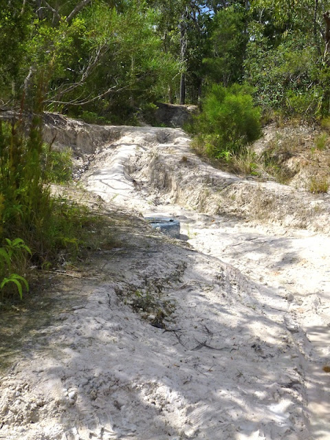
Canal Creek was about a kilometre and a half from camp. There were a few options for crossing and even to our inexperienced eyes it looked like we could make something work. Bear in mind that our primary objective is to get where we want to go without doing damage to our vehicle. After some deliberation this was the route we decided would probably be the best bet to achieve that objective ...

An old section of the track down to the creek had fallen out of favour. What can you see in the middle foreground of the photo below?

Yes, it's a tire that has seen better days ...

Around the creek itself some nice flowers were out ...


Less striking but very interesting were these more muted flowers ...

With the wet weather we'd been having there was some grevillea coming into flower ...

After wading across the creek I put my shoes back on at the rocky bank where we would exit with the vehicles. The photo doesn't show depth of field very well but if you look closely you can see that there is a bit of a sharp rise out of the water ...

We were confident that we could at least get across this creek. However, we were pretty disappointed - well no, it would be more honest if I used the word disgusted - to see some of the environmental damage that had been done on the northern side of the creek ...

At the top of this mess was a bull bar that had become detached from its vehicle ...

... and what was left of a couple of mud flaps ...

At yet another spot there was a lost muffler ...

One wonders at what point people draw the line in terms of knocking about both their vehicles and the environment they purport to love. With the growing numbers of people visiting this area (our Cape York atlas asserts that about 100 vehicles per day are traversing the OTT in mid July at the height of the season) I think that people are going to have to adopt a different mindset if they aren't going to love the track to death.
Anyway, once we'd decided that Canal Creek was fine to cross we walked the 4 kilometres on to Sam Creek. Along the way there were lots of places like the one below, where water erosion had caused alternative routes to become established on either side of the original track ...

There was a lot less debris scattered around Sam Creek when we arrived than we had seen at Canal Creek, but just above the sharp descent to the watercourse we did spot this old fridge ...

Sam Creek also looked fine to cross as long as you stuck to the correct line. In the photo below there are a couple of holes you need to keep to the right of ...

Happy that even we - the least experienced twosome in our group - could confidently cross these two creeks, Di and I headed back to camp where the others had enjoyed the sunshine and a swim. Di and I had a plunge ourselves but didn't get any photos as we did the long swim down the saucepan on Elliot Creek again.
On to Vrylia Point
Our goal for the next day was to explore the route out to Vyrilia Point on the Gulf of Carpentaria. I'm guessing at the moment but I'd say it's perhaps halfway between Weipa and Seisia. Before getting there though we had the creek crossings to deal with, and another interesting little challenge I'll talk about later.
If a picture is worth a thousand words, how much a video or two? Once again, it was fantastic having Graham along as a cool presence. He was happy with our choice of route choice for Canal Creek and calmly drove across setting a great example for the rest of us to follow ...
He then positioned himself to ensure that I didn't drop into any of the deep holes. For her part, Di added a directorial touch from behind the camera ...
On to Sam Creek, and Max's Big Red Truck make mincemeat of the crossing there ...
Apart some sustained corrugations on the road to Vyrilia Point, we had one test left to pass before arriving at camp for the night. This is the log bridge crossing that you encounter about 4 kilometres off the main road. Here's Max making it over with Prue's help ...
On we pressed through some beautiful savannah forest and not-so-beautiful corrugations along the road.
Just before arriving at the point, one finds this unmarked but fenced-in grave ...

Beside the grave were the scorched remnants of what must have been the previous grave marker. It didn't look like there had been a bushfire, so the conclusion one draws is that it had been the subject of thoughtless vandalism. Whoever had put it in in the first place apparently were determined to deter anyone from doing the same thing again with the erection of the wire fence.
We weren't quite sure how to get down to the beach and drove along to where there was a lookout over the point itself ...

.. but we had to backtrack to get down to the camping area. Just before we started the winding track down to the water's edge we came across this indictment of some of the folks who use the area ...

A little too much to pick up and put in the back of the Prado, unfortunately. You know, I just don't get it. People spend untold amounts of money on expensive vehicles and camping gear - not to mention the accessorising - because they like to get out to some of these beautiful place,s and then behave like they are at their local rubbish dump. As Pauline Hanson, one of our less-than logical former politicians says ... Please Explain!
Despite the best efforts of some to ruin the place, Vyrilia Point is a lovely location. Unfortunately the best campsites were taken, and looked like they had been occupied for some time. One of them had some net floats hanging from a tree ...

Our campsite was nearby. And the camping here was free, which was very nice ...

That evening Di got a lovely shot of the beach at sunset ...

... and after reliving the crossings and and explorations of the day in front of the fire we headed off to bed, mindful of the long drive ahead on the morrow.
By the way, there are a couple of other areas to camp at Vyrilia Point. One of them is south of the main camping area, apparently it is a bit rocky; the other is further north along the beach about 15 kilometres past an old wrecked lightship. We briefly contemplated an exploratory foray up that way but, as we had already decided we wanted an early departed the next morning and - after I was momentarily stuck in soft sand because I hadn't let my tires down - we abandoned that idea for more time at the main camping area. In the end we were glad we did as quite a number of vehicles arrived after we did and set off for the northern camping area, which was likely to be a bit noisy.
By the way, there are a couple of other areas to camp at Vyrilia Point. One of them is south of the main camping area, apparently it is a bit rocky; the other is further north along the beach about 15 kilometres past an old wrecked lightship. We briefly contemplated an exploratory foray up that way but, as we had already decided we wanted an early departed the next morning and - after I was momentarily stuck in soft sand because I hadn't let my tires down - we abandoned that idea for more time at the main camping area. In the end we were glad we did as quite a number of vehicles arrived after we did and set off for the northern camping area, which was likely to be a bit noisy.
A Day on the Road
So, the next morning we set off back out to the main road. After getting back through the corrugations and to the log bridge crossing we paused to do a few little adjustments ...

The view above is the one you get as you approach the bridge from Vyrilia Point. It's a fairly tight turn off a bit of a gradient. For the two Prados there wasn't really much of an issue except simply to take things slowly and carefully, but Max's Landcruiser RV and the longer tow bar on his Ulti meant that he had to be a bit more precise with his approach. Here's Liz doing a wonderful job of making sure he gets it right ...
Back on the main road we were delighted with the condition of the surface. The showers that had been about were not enough to make things slippery but perfect for keeping the dust down for a lot of the way south. At one point Liz radioed that there was a goanna trying to cross the road. It was pretty oblivious to the traffic racing past and I thought I might try to shepherd it off the road and get a photo at the same time. Well, it wasn't the least bit interested in being moved on, but I did manage to get a reasonable snap ...

I slowed some vehicles down that were approaching behind us before getting back in the Prado, so they didn't flatten this amazing prehistoric throwback. Hopefully it escaped becoming a pancake and got to where it wanted to be!
A little further on we had a bit of a break at Bramwell Junction roadhouse, which is on a big bend and these great looking termite mounds are scattered amongst the grass...

After a marathon driving effort we finally arrived at a fantastic campsite alongside the Coen River just north of the town of Coen. Here's a view of the river ...

Again, Di was prowling around with her camera and got a nice snap of some flowers on the water's edge ...

We had another very nice - and free - campsite ...

... where we had an enjoyable evening, complete with Chocolate Self-saucing Pudding. Not having a recipe we had to wing it, but it cooked up a treat in our little two quart camp oven which just fits in the Weber Go Anywhere Barbecue. We were all conscious of the fact that our journey together was drawing to a close, and that we would leave the ruggedness of the Cape York area behind the next day, so it was a quietly reflective evening, contemplating the great journey we'd had which was nearing its end. We were also conscious of the fact that we still had a bit of a trek ahead of us the next day. Our goal was to get to Endeavour Falls Holiday Park via Rinyirru (Lakefield) National Park and Battle Camp Road so we could finish with a couple of short days.
Leaving the Cape
The first notable feature that one encounters in Rinyirru is Nifold Plain with its seemingly endless termite mounds. It's a beautiful sight but hard to capture with a camera. Nonetheless, I took a couple of pictures from different angles of this termite mound which will give you some idea of the place ...


A bit further on we saw some Kapok Trees just before a river crossing ...

... and then it was on to the first of three remarkable ponds. At Low Pond we treated to our first definitive sighting of the magnificent Brahminy Kite, hunting along the shore. Unfortunately we didn't get a photo as it was a bit too far away for our camera. (We're hoping that Graham got a snap or two with his mega lens, and that he will send as one after he's sorted through his thousands of photos from the trip.) The main attraction at Rinyirru is the birdlife and this was to be just the first of a number of exciting observations as we passed through the park.
Next it was on to the Lotus Flower - or Red Lily - Pond, where we were greeted by hundreds and hundreds of Red-tailed Black Cockatoos taking to the air. And what a cacophony they made! It was absolutely wonderful. We took a very unsatisfactory video that I won't share - you'll just have to go there to experience it for yourself. Suffice it to say the excitement was enough to make my scalp tingle. The lilies were almost completely finished flowering so we could only wonder at how beautiful the pond must be when it is in full bloom. Near the lookout there were a few blossoms still out including this one beside another that had gone to seed ...
Next it was on to the Lotus Flower - or Red Lily - Pond, where we were greeted by hundreds and hundreds of Red-tailed Black Cockatoos taking to the air. And what a cacophony they made! It was absolutely wonderful. We took a very unsatisfactory video that I won't share - you'll just have to go there to experience it for yourself. Suffice it to say the excitement was enough to make my scalp tingle. The lilies were almost completely finished flowering so we could only wonder at how beautiful the pond must be when it is in full bloom. Near the lookout there were a few blossoms still out including this one beside another that had gone to seed ...

Our next stop was White Lily Pond, where the lilies were still flowering ...

Along the edges of the pond there were also scatterings of tiny flowers which are apparently called Frilly Lily ...

... and there were lots and lots of Magpie Geese wandering around amongst the larger white lilies. Here's a few of them doing their goosey thing, pretty much unconcerned about our presence ...
Lots of other aquatic critters frequent this incredibly rich environment, including the remarkable Comb-crested Jacana, which was strutting its stuff on the tops of the lily pads.
Di and I were so taken with Rinyirru National Park that we think we might come back for her 70th birthday - or perhaps a little earlier in the year if the roads are passable. We'd dearly love to see the Lotus Flower Pond in rampant bloom.
All good things must come to an end, and so did our drive through the park. We had a short side trip to Kalpowar Crossing Campground on the Normanby River for a stickybeak before pressing on south again. (I thought we were going to cross the Normanby River, so I blithely drove across the floodway, only to be told I had to turn around and cross again.) The rest of the day's drive was a little slow, at first due to road words and then due to the nature of the terrain: steep and windy through the broken and rocky hills of Battle Camp Road, which is quite wild and beautiful, but a little tiring at that stage of the day. We finally emerged from this rough country and arrived at Endeavour Falls not long before last light, for a well-earned rest.
Over the Bloomfield Track
Thankfully, there was no urgency to get moving quickly the next morning - especially as it was Di's birthday! We planned to cross the Bloomfield Track and have an early finish at Cape Tribulation Campground. Before that though, Prue wanted to make a short detour into Cooktown and the bakery there. That done, the six of us drove on to the Lion's Den, where we had spent our first night together three and a half weeks earlier. Luckily, this time there was no rain. Even more luckily, we passed through just in time to be let past an oversized vehicle that was in the process of transporting a house to Wujal Wujal. Had we been a half an hour later we would have been held up for hours, as the road is very narrow and twisty and I'm sure it would not have been possible to sneak by.
We were all keen to stop at the Bloomfield River to have a look at Bloomfield Falls, especially Liz who was still desperate for a sighting of a crocodile. Before heading up the river we paused for morning tea. Prue's mission at the Cooktown Bakery became more apparent as she produced a cake and candle to properly mark Di's 63rd birthday ...

The candle was ceremoniously lit and Di proceeded to blow it out ...

On the way up the track to the falls, Liz's hopes were realised when we spotted this impressive Saltwater Crocodile basking on a rock near the opposite bank of the river ...

It would have been somewhere between 3 and 4 metres long, so we were very pleased it was a long way away and looking very well fed! (Later, when we arrived at Cape Tribulation we were amused to discover a postcard with just this photo on it. Clearly this crocodile has stated claim to his patch of the river.)
On to the falls we went ...

... which were an impressive sight, but we all wondered at how the water must thunder over during a period of sustained rainfall as you can see to the right of the current flow another course at least two or three times the width of where the water is falling.
The drive over the Bloomfield was much tamer than all of us remembered it, probably because the road is both wider and in much better condition. The longest of the steep hills has been sealed with concrete and all the river crossings were in good condition. You'd still probably want a four wheel drive vehicle to be on the safe side, but we did see a couple of Subarus heading north. Certainly I wouldn't be wanting to tow anything up and down those steep inclines without the power of a proper 4X4.
The camping at Cape Tribulation was very good and we set off for a walk to the end of the beach once we were settled in. That night we our las dinner together. The Cape Tribulation Campground is renowned for its wood-fired pizzas, and we weren't disappointed. Highly recommended if you are passing this way.
The Last Day
Before we departed the next morning Di had another walk on the beach. She thought this leaf trapped in the sand looked like a bear ...

... and she got another new bird sighting to tick off on her bird App in the form of a Beach Stone Curlew ...

Can anyone name this flower for us ...

We did the tourist thing and picked up some postcards and some little rainforest-themed gifts at a couple of shops before pushing further south and dropping into the Daintree Discovery Centre. It looked like a great facility, but none of us felt like spending the time to justify the $32 per head entry fee as we were all keen - for various reasons - to keep moving. I was amused enough by the sign above the toilet to take a photo ...

On to Daintree River, where - at $13 - the ferry fare was considerably cheaper than the $135 we paid to cross the Jardine River further north ...

Max, Prue, Graham and Liz were keen to stop at Mossman Gorge on their way south. Di and I had been there before and were getting pretty antsy about seeing the grandchildren again, so we agreed to stop at the northern edge of town where we'd rendezvoused on the first day of our trip.
They do nice things with toilet blocks in this part of the world ...

Our time together wouldn't be complete without one last self-timed group photo where our northern sojourn really began ...

We said our goodbyes and Di and continued south. As we neared Port Douglas, the roadside was punctuated with signs advertising fresh prawns at the wharf. We hadn't intended on detouring but the thought of fresh prawns to take to Cairns and the possibility of lunch in Port Douglas lured us off the highway. As it turned out the town was heaving with tourists and locals enjoying the fine weather and first weekend of the school holidays. We decided to grab some prawns - which were absolutely fantastic and an excellent buy at $18 per kilo! - then continued to Ellis Beach for a delicious lunch.
That's about it for the trip to Cape York. I might make another post or two on the trek back to Tassie but may not find the time. However, I'd like to thank our travelling companions for a wonderful time together, Max especially for suggesting the trip when we met at Potato Point on the south coast of New South Wales almost a year ago and putting it all together, and Graham for his calm and steady approach to the more technical aspects of our journey. From my point of view at least, this has been the most interesting and varied trip we've done with the camper to date and we feel better equipped now to tackle more challenging terrain. We learned a lot travelling with you guys and hope we can do some more trips together in the future.
Cheerio!