
Hawker: Gateway to the Flinders Ranges
On its official website, the settlement of Hawker describes itself as "a great little outback town". Although a friendly enough place, that description is, perhaps, a bit of an overstatement. I wasn't sure it would actually qualify as a town but, surprisingly, according to Wikipedia, the population in 2006 comprised 229 souls. Bigger than it looks. (Where is everybody?) So, I guess calling itself a "town" is fair enough, but there doesn't actually appear to be much to do there.The old route of the famous Ghan Railway used to pass through Hawker, and the station has been preserved and turned into some sort of tourist business - which was closed when we pulled up. The station still looks pretty good ...

... and an old hoist stands beside where the old line used to run ...

It had been fairly cold for the week or so before we arrived in Hawker so I was pleased to find a good warm beanie at the fuel station. (To you Canadians reading this, that's not a beanie but a toque, which some people apparently call a "knit cap", if you can believe that.) After visiting the Jeff Morgan gallery and buying postcards of some of his work as the originals were way out of our reach, we fired them off to the grandkids and a few others. By the time we'd filled the Prado with diesel it was time for an early lunch at the Hawker General Store ...

Anyone looking closely at the above photo who knows their geography might be shocked. I was. Can you believe it: a store in a little town in outback South Australia sporting a sign for VB - a non-South Australian beer!?!? Apparently the Croweaters aren't as parochial about beer as they are about footy.
Anyway, the menu in the café/post office/general store/supplier of imported beverages showed steak sandwiches with the lot at the amazingly low price of $10.80. We looked at each other and came to the conclusion that that would do - for the both of us, but without the pineapple thank you very much.
And what a great sandwich it was, with more of "the lot" than any burger I'd had for a very long time. Actually, we couldn't believe how much bacon the burger man stacked in. We thought they must have been trying to cope with something of an outbreak ...

Into the Heart of the Flinders Ranges
With both the Prado and us fuelled up for the foreseeable future we rolled off into the heart of the Flinders Ranges, but in much more comfort than when we passed through here in 2011 when we were still doing the car camping thing. We were really looking forward to an extended stay beneath the famous crag of Moonarie. Here's an evening shot of our campsite with the Ultimate fully set up ...
... and another from the morning with the crag behind ...

Not a bad spot, eh? It's about a 45 minute walk for us old crocks up to the base of the cliff, with around 300 metres of elevation gain. A nice little warm-up before doing a climb. Yeah, right. More about that later.
In the mornings and evenings there were lots of kangaroos close to camp; occasionally a couple of emus would wander by; and we were regularly visited by the local Red-capped Robin, an exciting caller as it was the first we'd ever seen. We tried to get a reasonable photo but he was fairly shy and this was the best we could do ...

If we' are to continue this creeping around the country caper then we might just have to invest in a better camera! In the meantime you can get a better gander at this beautiful little bird here.
On both the first and the second days of our stay it was pretty cool and the crag was shrouded in cloud. The cliff faces southeast so at this time of the year it's best to climb in the mornings, but given the prevailing weather conditions we decided on alternative game plans. The main event for day 1 was a 44 km ride on the bikes: along the main road to the entrance to the Flinders Ranges National Park, a turn off to the Mawson Trail through to Wilpena and then along a shared section with the Heysen Trail. As you can see from this photo of Di it was pretty cool ...

... but we had a lot of fun. The terrain was mostly an old four wheel drive track without too much rough stuff. Along the Heysen Trail we enjoyed some wonderful single track through lovely Callitris forest. Best of all? No crashes!
Bunyeroo and Wilcolo Creeks Track
On Day two the weather still wasn't very flash so we decided to check out a hike. The Bunyeroo and Wilcolo Creeks hike is a 9.2 kilometre loop north of Wilpena. Traversing mostly flat terrain and gentle gradients through two small drainages, it utilises both the Mawson and Heysen tracks, as well a short section of road through the scenic Bunyeroo Gorge. Here is a shot showing fairly typical Mawson Trail terrain ...

I think it was just before we turned off on to the Heysen Trail that I took this photo ...

After about 2 pleasant, gentle kilometres on the Mawson Trail the route turns onto the Heysen trail, initially passing through open woodland ...

... before entering and ascending the Wilcolo Creek, sometimes in the creek bed itself ...

At this point we got quite excited. There was a sign alongside the trail telling us that we were entering the territory of the Yellow-footed Rock Wallaby, an extremely beautiful and rare species, once hunted for its wonderful fur. We had absolute beginner's luck when we saw this one in Brachina Gorge during our trip through the Flinders in 2011 ...

... but unfortunately didn't catch a glimpse of one this time around.
The trail gradually ascends for a while through Callitris forest, with the occasional little gem alongside the track ...

Eventually the track reaches elevated open slopes and the high point of the route at almost exactly the halfway point. A good place to stop for lunch, with fine views. Di noticed the little spur that leads to a lookout at a somewhat more elevated position and wonders if we should do the side trip ...

... but I didn't think that was necessary, given the view we already had ...

The next section of track was very exposed to the elements, and we started to notice the remains of both native and introduced animals fairly regularly ...

Eventually we found ourselves descending into Bunyeroo Creek. There were a number of spots where the bed was formed by rocky slabs ...

I keep trying to get that iconic image of Red River Gums crowding the watercourses but still haven't found it - except on a postcard I sent to a mate in Canada! We would pass the occasional gnarled giant standing firm in the creek bed ...

... but as far as getting a photo of a group of RR Gums, on this occasion I settled for stitching a few images together where the creek bed spreads itself wider ...

On the drive back to camp we were surprised to come past an emu that didn't race off at a speed of knots in many different directions, as they tend to do. In fact, this specimen was so sedate Di managed to get a bit of close-up footage ...
... and so it was back to camp to plan the next day's activities. The forecast was for a fine day before rain the day after, so we were pretty keen to get up the hill and have a climb. Before we went to bed we noticed a vehicle pull into the campsite a bit closer to the crag, so we thought we'd probably have company the next day.
Exploring The Options
The next morning was indeed fine enough to venture up the hill. As I said previously, it's about a 45 minute hike and 300 metres of elevation gain to get up to the climbing from camp. Most people carry their gear up the first day and leave it there for subsequent days' adventures. We plodded our way up the hill and turned right - into the shade. I had this deluded idea that we might be able to climb a stunning-looking three pitch route with the brilliant name "Miles From Nowhere" that I had spotted on our last visit in 2011. We didn't get on it that trip because the weather was mostly cold and wet, and I'd been thinking about it ever since. After standing around at the base for a few minutes and realising that it was too cold for us to do a multi-pitch climb if we didn't want to freeze, we decided to head over to Top Camp, which was in the sun, and re-evaluate the situation. When we got there, we discovered our neighbours had arrived just before us. And it turned out that we had made their acquaintances - separately - in the environs of Natimuk and Mt Arapiles. We'd seen Esther in the Arapiles Mountain Shop just before heading over to Moonarie, and we'd met Duncan - who is a friend of a friend in Hobart - a few years previously around the campground at Mt Arapiles. The climbing world is a small one.
Esther and Duncan had a game plan that involved sunshine and a three star route called Pine Crack on Checkers Wall. We thought that made sense and decided to follow them around there and have a look for future reference. We watched them for a while before exploring options further afield. Here's a photo of Duncan at the belay atop pitch 2, after running the first two pitches together ...

We wandered around to a face called Gargoyle Wall as it was still in the sun and had climbs that were easy enough for us to get ourselves going. We decided to start on the easy and classic Gargoyle and then do something a little harder. It was brilliant and quite audacious for the grade and the era in which it was first climbed. Unfortunately the wind had come up by the time we got to the top so we bailed, looking forward to coming back another day ... but not the next, as the weather forecast said 90% chance of rain.
After a long lie in, a good big breakfast, some reading and still no rain we thought we might as well do something with the day. Wilpena and ... internet shopping!!! We'd been wish-listing more lightweight gear to comfort ourselves and ease the burden on our ageing joints so decided to take the plunge and spend the money. Because the stuff we wanted couldn't be shipped out of the country by the retailer, this involved setting up a freight forwarding account, which we'd heard about but never done before. A quick internet search got us going and, after reading a few reviews, we settled on a company and placed our order. Fingers crossed that the goods arrive!
Once that was done and it still wasn't raining we thought we'd take the short drive to Sacred Canyon and have a look at some etchings. On the way into the canyon we found another hidden surprise ...

Naturally, as we entered the canyon itself, the first of the promised rain started to arrive. You can see where drops are hitting the pool behind Di ...

Even in the dull conditions there was still some nice colours in the rock ...

In really hot weather, this little canyon must have been a wonderful sanctuary to the Aboriginal men who lived in these parts. We did manage to get a look at some engravings ...

As we beat our retreat from the impending rain I paused to frame up this shot of these neat textures of gnarled, bulbous root stems and weathered bark ...

While Sacred Canyon isn't a grand and striking natural feature, it's well worth a visit if you're in the area. To wet your appetite further, this guy's photos are much better than mine and have some great colour. On the way back to camp the showers became more consistent, and by the time we were tucked into our camper it was raining steadily. And it rained pretty steadily all night.
The next day's forecast was for showers clearing. Going up the hill for a climb didn't seem very attractive; although it had actually cleared up overnight we thought the rock would still be wet and the rain might move in again. However, unable to be inactive for two consecutive days we thought we'd ride another part of the Mawson Trail, this time down towards Brachina Gorge from the north. Unfortunately, one of us had a crash. Maybe the less said about that the better, although the crashee said afterwards that it was a "good ride". Only one photo from that day (if you look at the photo full size you might be able to make out Di in the right background).

The next day we went back up the hill and did the climb that Duncan and Esther had been on earlier - but we only did the first two pitches. Another mix-up, with Di thinking that the supposedly easier bit went all the way to the bolts at the top of the second pitch, and that the final pitch was going to be significantly harder. She did a great job leading but was spent and not keen to continue. It wasn't until we were back on the ground that she realised she'd led a 19 and could have easily followed me up the next bit. Lesson? Read the guide book!
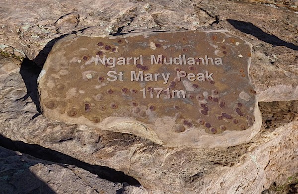
St Mary Peak
The next morning the weather looked just a bit patchy. Di was already ambivalent about another trudge up the hill and then the rigours of the fairly demanding climbing that is Moonarie, so we decided to take a hike. St Mary Peak is the iconic walk in the immediate vicinity. We'd been up it via the shorter route in 2011, so we decided to do the full loop this time, starting with the Inside Track and finishing on the Outside Track. As we were leaving the environs of the Wilpena Resort we passed this amazing tree with a "window" in it ...

The first part of the walk is along an old four wheel drive track, eventually giving way to a walking track once the terrain becomes more rocky and rugged. The rain over the past month or so is bringing lots of plants into flower, including this pretty little shrub alongside the track ...

Many of the Grass Trees have also sent up spikes ...
 |
| Grass Trees with St Mary Peak behind |
Here's a close-up of some flowers on one of the spikes ...

We were pleased with how quickly we were covering ground, after we'd stopped off in the Wilpena campground to have a chat with our friends Graham and Liz (folks with whom we will rendezvous again in a few days to travel north). Graham said, "That's a nine hour hike, isn't it?" And I said to Di, "It's quarter to ten - we'd better get going!" We were at the top in time to have a leisurely, enjoyable and not too late lunch. Here's what you get to see if you go right to the top of the peak ...
... as well as a great view back over Wilpena Pound itself ...
 |
| Wilpena Pound from St Mary Peak |
We were back at Graham and Liz's campsite at 3:30, pretty much exactly five and three quarter hours after setting out. Not too bad for a couple of old crocks.
Yesterday the weather was magnificent and we ventured back up the hill. It turns out that our legs were a little tired. Hmmm. Funny that. For some reason we keep forgetting to factor in the walk up to the crag when we're thinking about what we might climb. Anyway, I had a mind to get on a route called "Seduction". A good looking climb with a star and of course, like "Miles From Nowhere", a great name. Here's what the route looks like (I've traced the line in red) ...

It turned out to be quite hard for the grade. Or maybe I was just worn out. I got up it, but only just. Di did too. After we rappelled the route and repaired to Top Camp for a snack and I wondered aloud what we might do next, Di made it very clear that she was finished climbing for the day - and this part of our trip! So down we went to a huge lunch: two jaffles each, made with sautéed sweet peppers and aubergine and crammed with cheese. Very restorative, especially with a cool beverage. Later, I did most of the camp pack-up while Di had a snooze so we could have a leisurely departure today.
Here we are, all packed up and ready to leave Moonarie this morning ...

... and exiting the little road that leads into our campsite ...
We haven't come far: just down the road to the Pound. A pretty relaxed day. Di has done the laundry while I've faffed about on the computer. Tomorrow we'll have another ride. The next day we'll push north a little way before meeting up with Graham and Liz at Leigh Creek the day after that, before we head towards more remote parts of the country. It will probably be a while before the next post ...
No comments:
Post a Comment